How to get to Samson Canyon
The track was marked in December 2022. Used free offline navigator - Organic Maps (analog MAPS.ME ) you can freely download to your phone on Google Play.
The beginning of the primer is 36°42'15.05"N, 33°41'26.57"E
Fork - take the right - 36°42'06.48"N, 33°41'49.88"E (here we left the car so as not to disturb the locals, as further the road passes through the garden. )
Fork- take right 36°42'03.21"N, 33°41'48.65"E
Fork - take the left -36°41'57.55"N, 33°41'40.7"E
The beginning of the trail descent to the ledge - 36°41'42.9"N, 33°41'47.63"E
The gate on the trail (please close the gate behind you, this is important for local residents) -36°41'38.62"N, 33°41'46.26"E
Observation deck directly in front of the arch - 36°41'35.77"N, 33°41'42"E
READ - our report on a trip to Turkey by car with a tour of the Sason Canyon
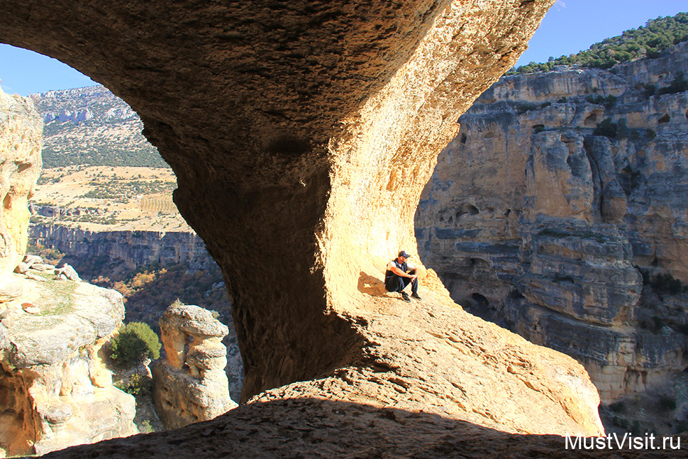
The most beautiful arch in Turkey in the Sason Canyon